For clubs
Give riders a record they can trust
Bring your club's knowledge into one place, keep trails and conditions current, and review what riders report before it becomes official.
See the club workflow
Built for where you ride and what you ride
A shared trail record built with local clubs and riders, available online or offline.
We’re looking for Android and iOS beta testers now. Beta access is by invitation only. Create an account, sign in, then request an invite. Help build the trail record for your area: report what you find, fill in missing trail data, and give the next rider better information. Rider-submitted data stays unofficial until the responsible club takes ownership of the trail system and reviews it. Until then, trails DynamicTrail has checked are on the map and marked Unofficial.
Android and iPhone launch together. The iPhone public release ships alongside Android; CarPlay follows later this year.
Clubs make information official. Riders help keep it current by sharing what they see on the ground.
For clubs
Bring your club's knowledge into one place, keep trails and conditions current, and review what riders report before it becomes official.
See the club workflowFor riders
Plan on trails the club's latest information shows as open and eligible for your machine. Then report hazards, corrections and missing details so the next rider has a better answer. If no route connects, DynamicTrail tells you what stopped it and where.
See rider featuresBring GPX or KML files, local knowledge, or just a description of the area, and we build the trail system with you.
Report a hazard, a correction, a condition or a missing detail from the trail, even with no signal.
Club volunteers review what riders send and apply, adjust or decline it. Nothing on the official map changes until they do.
The next rider gets better information, and adds what they learn in turn.
What it does
On the trail, at the club's desk, and on the dash. Choose one to see it.
A shared effort
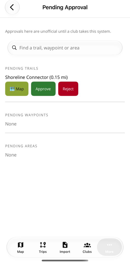
The club's tool
One report, start to finish
Screen recordings with example trail data, not current conditions. No sound.
Try the map
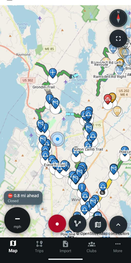
Trails are drawn in the club's colours, a marking sits on the stretch it applies to, and pins show what is at a spot. Hover or tap one to see what it is.
A sample of the map
Trails, markings and pins on a few square kilometres of test ground. Drag and zoom it.
Help build the record
Clubs bring the trail system and decide what is official. Riders report what they find. Each one helps the next person plan a better ride.